
Explore Wood Farm with OPT
Wood Farm in east Oxford has an interesting and varied history. In the last century, the area was transformed from farmland and open fields to a place full of new kinds of housing and facilities for Oxford’s growing population. We've been exploring its importance within Oxford at each stage of its changing use.
Through our Wood Farm Community History project, OPT is researching and recording local stories alongside residents and community groups. You can read more about our ongoing activities below and there are lots of ways you can get involved.

How can you get involved?
- Would you like your memories of the area to be recorded?
- Do you have photos of Wood Farm over time that you would like to share?
- Have you ever wanted to know more about the history of your house?
- Do you have your own questions about Wood Farm's history? Would you like to help us undertake research?
- Have you recently moved to Wood Farm or the surrounding neighbourhoods? How would you tell the story of the area?
Get in touch with us using the webform below or email our Engagement Officer, Anna, at a.clark@oxfordpreservation.org.uk
Discover Wood Farm's local history
We've been working with local historian Liz Woolley, whose report, 'A History of Wood Farm, Oxford', is now available to download here. Her research tells the story of the area, from its use in the 1200s as a royal hunting forest until its development in the 20th century. It was transformed into new place to live for families relocating within Oxford and for those moving to the city for the first time. The report is full of historic photos, documents and aerial images of Wood Farm and you can even find out how your street got its name.
But Wood Farm's history doesn't end here. We need your help to record experiences of Wood Farm after 1975! What is your story?
Image credit: POX0132322, Oxfordshire County Council, Oxfordshire History Centre (see Picture Oxon)

Wood Farm History Walk
We’re tracing Wood Farm’s history through its buildings, places and green spaces.
Our Wood Farm History Walk, produced thanks to a generous joint grant between the European Union and the Council of Europe, shows some of the areas we have begun to explore. Thank you to the residents and former residents who have contributed and made suggestions so far.
Some sites are no longer visible but have an important story to tell. On the map, you can see the outlines of three lost locations: the farm that gave the estate its name, a prisoner of war camp and a Second World War rifle range. We have also been finding out about the Territorial Army Centre, the original Slade Nursery building by St Francis Church and sites where Travellers have camped over many years.

Do you have connections to Wood Farm and the surrounding area? We’d love to hear more about the places that matter to you. What kind of histories would you like to find out more about?
![]()

![]()
Schools
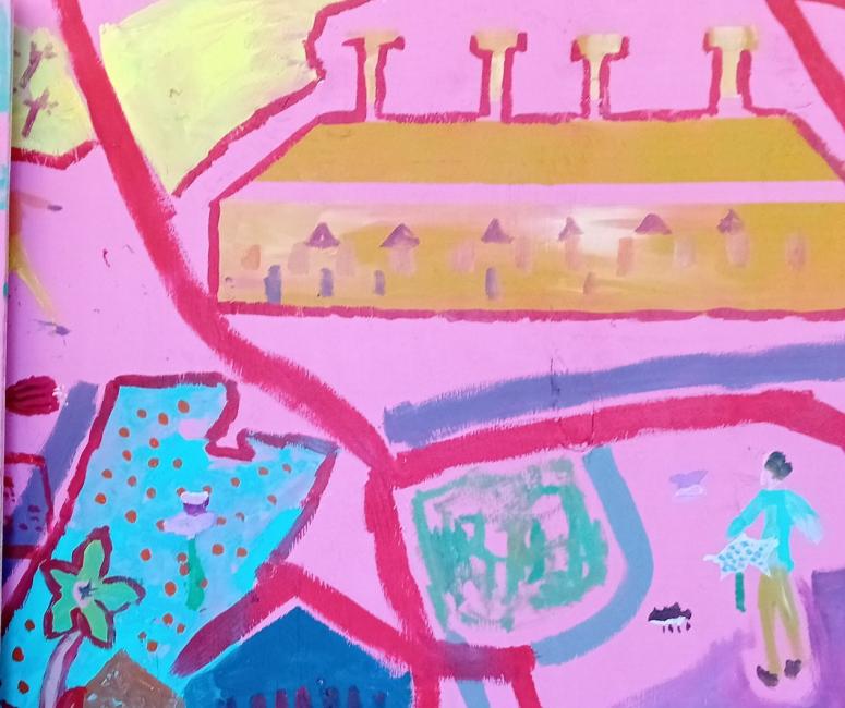
Pupils at Wood Farm Primary School have been using the Wood Farm History Walk maps to explore their local area and learn about human geography. As well as spotting the area's key features on their walks, Year 3 have been writing about the places that are special to them and the improvements they would like to make to the area, from basketball clubs to theme parks. They have also teamed up with local artist Alex Singleton and Healthwatch Oxfordshire to paint their own version of the map.

Some of the places we've been researching:
-
Rock Edge Nature Reserve
Headington was once full of industry; Old Road was home to a brick and tile works. This nature reserve was originally a quarry. The rock contains fossilised coral from a reef that was here in the Upper Jurassic period. During and after the Second World War, when rationing was in place, a Municipal Restaurant, a kind of community kitchen, served hot meals at Rock Edge. The City Council and the Friends of Lye Valley now look after this special geological site.

-
The Crown and Thistle
For over 160 years, the Crown & Thistle was the local pub here. Before that, there was a coaching inn on this site called Titup Hall. Riders and coach drivers could pick up speed here on the flatter land between Headington Hill and the steep slope of Shotover by asking their horses to 'tittup', or canter. Just opposite is the site of another Wood Farm landmark, Tilly’s sweet shop, a magnet for children from 1939 until the mid-1950s.

-
Mounting Stone
Old Road was the route from Oxford to London until around 1789. To help the horses to climb Shotover Hill, some riders would walk up on foot. These stone steps were given in around 1630 by a local doctor to help them to remount.

-
Wood Farm Primary School and the Slade Nursery
The Council designed the Wood Farm estate with a school at its heart, putting children’s learning at the centre of the community. The junior and infant schools opened in 1955-6 and new buildings were completed in 2014. The chosen site was a field behind the Crown & Thistle pub, previously used to graze the horses of Stays Stables.

-
Joan Lawrence Place
Joan Lawrence spent thirty years as the head teacher at the Slade Nursery. She died in 1988. Before its move to Titup Hall Drive in 1983, the nursery was on Hollow Way next to St Francis Church.

-
Stansfeld Place
This is an outline of the Old Road Camp, built during the Second World War. Between 1944 and 1948, Italian and German prisoners of war were held here. Afterwards, the huts were converted into council flats. They were later replaced by Stansfeld Place.

-
Foresters Tower
Building work on the tower started in 1965 to create 85 new homes over 15 floors. It is one of five high-rise tower blocks built in Oxford at this time and it was intended to provide a modern solution to the city’s post-war housing crisis.

-
Pether Road
Richard Pether rented the farm here from Magdalen College between 1850 and 1891. He upset local people by taking possession of land, known as Open Magdalen, that they used for food and fuel. William Morris, Lord Nuffield, was Pether’s grandson.

-
Nuffield Road
Willam Morris, Lord Nuffield, was the founder of Morris Motors and co-founder of Pressed Steel in Cowley. His mother, Emily, was Richard Pether’s daughter and grew up on Wood Farm. Nuffield bought the farmland from Magdalen College in 1934 for £26,000.

St Peter's College, Oxford, CC BY-SA 4.0 -
Atkyns Road shops
By 1960, these newly built shops and maisonettes included a greengrocer, a sweet shop and a newsagent selling toys, providing services for the new community. A mural with scenes from Wood Farm’s history was painted in 2000 and a mosaic illustrating the area’s rural past was made by local volunteers in 2017.

-
Magdalen Wood
This woodland nature reserve was formerly a piece of land called Open Magdalen. It had been used by local people since medieval times as common land to graze animals, catch rabbits and birds and collect firewood. Now cut in two by the by-pass, 10 hectares remain protected for public use in Wood Farm. Have you seen the wooden dragon sculpted by Stuart Turner?

-
Rifle Range
Now covered in trees as part of Broad Oak Nature Park, this spot was once a rifle range in the Slade Army Camp, used to train infantry during the Second World War. The soldiers’ huts were later converted into council housing. To find out more about this historic site, see the research collated by the Friends of Slade Camp here: Slade Camp | Shotover Preservation Society

-
Peppercorn Avenue
This street began as a row of pre-fabricated aluminium bungalows, which were part of the Slade Army Camp, a military training centre set up in 1939. The huts were later converted into and most reclad in brick. Originally Fifth Avenue in the camp, it was renamed in 1977.

-
Leiden Road
This road curves around the outline of the former site of Wood Farm, which gave the estate its name. The farm existed from the late 1700s until about 1970 and was known in the 20th century as White’s farm, after farmer Thomas White. After its demolition, Leiden Road was built in 1976 and named to celebrate Oxford’s twin city in the Netherlands.

-
Pauling Road
The Council planned Wood Farm’s first 116 houses in 1951. They were built on Pauling Road, Palmer Road, Titup Hall Drive, Masons Road and Wood Farm Road. They were assembled by pouring layers of concrete into steel frames on site and are known as ‘Easiform’ houses. There are different Easiform designs across Wood Farm – how many can you spot?

-
The Bullingdon Community Centre
The Bullingdon Community Association was created in the early 1950s to promote and provide a place for community activities. It continues to fulfil this important role and its new building, designed with and for local communities, opened in 2023. The Centre was one of the winners of the 2023 OPT Awards.

-
Lye Valley Nature Reserve
Also known as Hogley Bog, Lye Valley is a marshy area between the Slade and Oxford Golf Club. The Friends of Lye Valley have transformed it from a small brook into a thriving fen, home to rare plants, such as grass of Parnassus, and a variety of wildlife.
